How to choose a Dalat hiking trail for half a day, a full day or overnight
Go hiking around Dalat when the trail has had time to dry, your group can finish before dark, and you have a route that matches your fitness. Postpone a forest hike after heavy rain, especially when the route includes stream crossings, exposed slopes or temporarily closed park trails.
By Da Lat LoversPublished Updated Đọc bằng tiếng Việt
Dalat hiking: find a trail you can finish comfortably
At Bidoup Nui Ba National Park, the 3.5 km Thien Thai walk takes half a day, while the Bidoup summit trip runs two days and one night. Both count as “Dalat trekking”, yet they ask very different things of you. You can walk among pine trees for a morning, spend a full day on a guided forest route or camp in the mountains overnight, but you need to decide which experience you want before booking transport.
Which Dalat hiking trail fits your time and fitness?
| Trail or area | Published or typical distance | Time to allow | Physical effort | How to access it |
|---|---|---|---|---|
| Xuan Huong Lake | About 5 km for a complete circuit | 1-2 hours | Easy, urban walking | Independently on public paths |
| Hon Bo hill | A mapped short route is 0.85 km; other approaches vary | Roughly 1-3 hours, excluding the drive | Easy to moderate; a short steep climb | Publicly accessible approaches only; local help is wise before dawn |
| Pinhatt Peak, Tuyen Lam Lake area | One recorded point-to-point route is 4.2 km; return trips are longer | Allow 3-5 hours for a fuller hike | Moderate with loose, sloping ground | Confirm the current legal trailhead; a local guide is useful |
| Thien Thai, Bidoup Nui Ba National Park | 3.5 km | Half a day on the route | Easy to moderate | Book the park's guided program |
| Thien Thai to Dung Jar Gieng ranger station | 10 km | A full day | Moderate; endurance matters | Guided park program |
| Hon Giao, Bidoup Nui Ba National Park | 2 km and 7 km educational routes; tour distances vary | Half-day, day or overnight | Moderate to strenuous depending on program | Arrange the named route with the park |
| Langbiang's Nui Ba summit, 2,167 m | Depends on the authorized route | Usually reserve 6-8 hours | Moderate to challenging, long climbing | Confirm that summit access is open and arrange the required guide |
| Bidoup summit, 2,287 m | Officially the 17 km ecological route; confirm the real distance when booking | Two days and one night | Challenging | Book a permitted guided park trek |
| Ta Giang, Khanh Hoa | About 12 km to the grassland on one approach; whole treks often cover 20-22 km | Two days and one night | Moderate gradients but long walking and streams | Go with an organized group and local route leader |
The effort column is a rough guide for planning. A four-kilometer trail with more than 400 meters of climbing can be tougher than a ten-kilometer walk on level ground. Equally, a relatively gentle streamside trek can become demanding when the group carries overnight equipment or has to walk on wet stones.
Start by considering the least fit person in your party. Walking around town all day is different from several hours of descent on muddy soil. A regular walker who can manage a few hours of hills may enjoy Pinhatt. An experienced hiker who has already completed long days on uneven ground can consider a full-day national park route or a properly authorized Langbiang trek. Treat Bidoup and Ta Giang as proper overnight expeditions.
Hon Bo: the easiest short hill outing to arrange near town
Hon Bo is northeast of central Dalat, around the Thai Phien area. The ride from central Dalat to the foot of the hill is roughly 9-12 km, depending on where you start and which approach you take. It is a convenient choice for a visitor who wants some open hillside, pines and a view without dedicating an entire day to a distant national park.
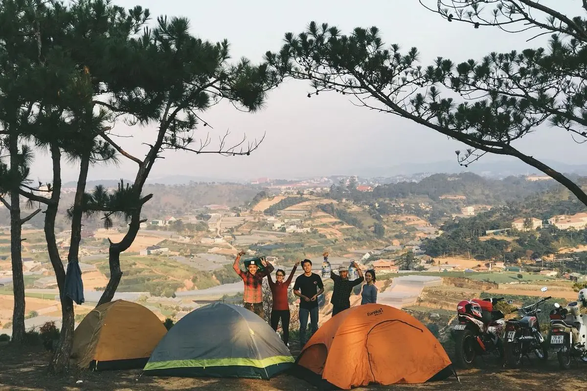
One short out-and-back route up Hon Bo is 0.85 km, with about 145 meters of climbing. Hon Bo has several ways up, and that number fits only one of them. Your actual walking distance depends on where your driver stops, where parking is permitted and whether you approach from a lower part of the hillside. Agree on the starting point before relying on the number in a route app.
The final access can be rough for scooters and the footpath becomes slippery on wet soil or grass. It is not sensible to drive further uphill merely to save a few minutes of walking. Park where permitted and leave enough time to get down the same way. Do not cut through cultivated land or assume that a tire track is an unrestricted public walking trail.
Allow one to three hours for the walking and time at the viewpoint, plus the journey from your accommodation. That leaves the rest of the day free. A daytime Hon Bo outing makes a gentler first Dalat hike than a pre-dawn solo climb. New to the approach? Arrange to meet a local guide at an agreed point instead of navigating dark paths by phone.
Pinhatt Peak: a proper climb above Tuyen Lam Lake
Pinhatt rises in the hills south of Dalat, overlooking Tuyen Lam Lake. The draw is a forest trail that ends in a high view across the water. The approach includes pine woodland, loose stones and steeper dirt sections. It makes a useful next step once a short hill walk feels too easy.
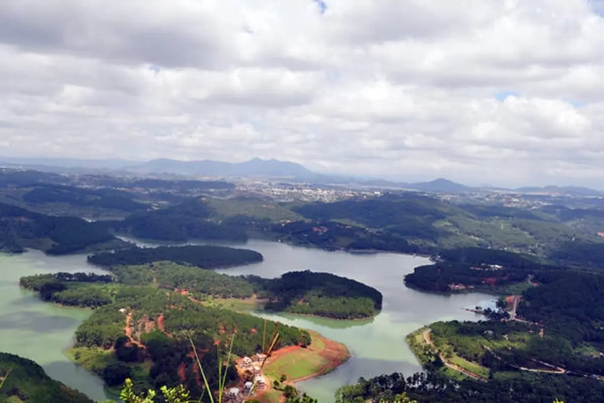
One route up Pinhatt is 4.2 km point-to-point, with about 422 meters of climbing and two to three hours of walking. Guided return hikes run roughly 8-10 km in total. Both figures hold up; the trailhead, turnaround point and return path make the difference. Ask whether the distance is one way, a return trip or a route between two different endpoints.
Most people need three to five hours on the trail itself. Climbing takes cardiovascular effort; descending tests balance and tired knees. After rain, walkers often slow down more on the descent than the ascent because each foot placement needs attention. Add time for breaks and locating the correct exit.
Getting to the general Tuyen Lam Lake area is straightforward by road, but finding a suitable, currently accessible trailhead is a separate task. Some tracks enter resort property, plantations or managed forest. Check the access arrangements before you set off. There is no reason to squeeze through a fence or use a private driveway because an old GPX file follows it.
A fit and experienced group may organize an independent hike on an open, permitted route, using an offline map and reliable local information. First-time visitors should favor a guide who knows the correct access point and can identify the trail junctions. A phone with mapping software is helpful, but a GPS line does not tell you whether a property boundary or access restriction has changed.
Begin in the morning. Carry your own drinking water, a small meal or snacks, a light insulating layer and a waterproof jacket. If the ground is very wet or fog makes navigation difficult, change the plan to public lakeside walking instead. An enjoyable half-day in the hills beats a summit reached in bad conditions.
Bidoup Nui Ba National Park: several walks, not just the summit
Bidoup Nui Ba National Park is the strongest option for visitors who want a structured forest experience with local staff. The visitor center in the former Da Nhim area, now part of Lac Duong Commune, is approximately 36 km from Dalat by the road toward National Highway 27C. Contact the park before traveling to establish the right meeting location and whether your preferred program operates on the chosen date.
The park offers short nature interpretation walks, longer day routes and overnight trekking. Its current price schedule took effect on 1 January 2024. Get a fresh quote for your own date.
Thien Thai trail
3.5 km, half a day in the forest
The Thien Thai route is 3.5 km and takes half a day. It is a sensible first forest walk for a visitor who is curious about the highland ecosystem but does not want long summit climbing. A guide walks with you and explains the forest along the way.
It costs VND 250,000 per adult and VND 150,000 per student. That covers admission, a guide and a picnic lunch. A general entrance ticket is VND 40,000 for adults and VND 20,000 for students, insurance included. Do not automatically add the general ticket to a tour rate that already includes admission.
Half a day covers the walking only; add the trip out from your hotel and back. You must get to the park, meet the staff, complete the walk and travel back. If you are leaving Dalat on an early afternoon bus, a city walk may be a better final-morning activity. Reserve Thien Thai for a day when you can comfortably absorb travel delays.
Thien Thai to Dung Jar Gieng
10 km, a guided full day
The route from Thien Thai to the Dung Jar Gieng ranger station is 10 km and takes a full day. It costs the same as Thien Thai: VND 250,000 per adult and VND 150,000 per student, including entrance, guide and a picnic lunch. At booking, find out whether the longer route actually runs on your date, not just whether spots are left.
Ten kilometers on forest ground is not the same effort as ten kilometers around a paved lake. Even where the gradients are manageable, roots, damp leaves and repeated changes in footing slow the pace. Build up your walking stamina beforehand, and keep enough energy for the last few kilometers. You will enjoy the landscape more if you are not rushing to catch a tightly scheduled dinner reservation back in town.
This is a good compromise for someone seeking Dalat hiking trails with a genuine forest setting but only one available day. The guide handles route choice and park procedures. You still need suitable footwear, water, weather protection and a realistic understanding of your own pace.
Hon Giao
Choose the program before comparing distances
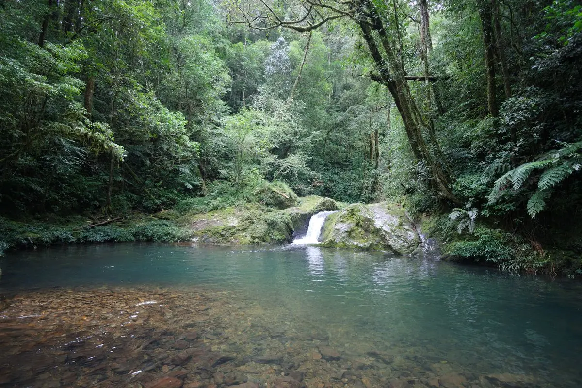
Hon Giao is another area covered by the park's ecotourism programs, on the mountainous road corridor connecting Dalat with Khanh Hoa. A half-day package costs VND 150,000 per person, including admission and a guide. The full-day package is VND 290,000 with a guide, lunch, drinking water and insurance. The two-day, one-night product is VND 1,590,000 with tents, guide, three meals and insurance.
Hon Giao also has 2 km and 7 km educational routes, but your package may cover a different distance. Ask exactly where the trip starts, where it ends, how much walking is involved and whether there are stream crossings. A short educational walk and an overnight Hon Giao trip are separate products, even if their location names match.
Hon Giao is especially worthwhile for visitors who want to see a different forest environment without committing immediately to the Bidoup summit. It also works for groups of mixed experience when the park can supply an appropriate shorter route. On a wet day, a guided program may be adjusted or canceled; ask about the decision process before departure.
Bidoup summit, 2,287 m
Two days and one night with a park guide
Bidoup Peak stands at 2,287 meters. Reaching it as part of the park's two-day, one-night trekking program involves sustained forest walking and a night at a designated camp. Conditions change as elevation rises, and the descent after the summit can be just as tiring as the climb. Plan around the full itinerary, not just the height printed on the summit marker.
Officially it is the “17 km Bidoup ecological route”. Some treks run longer when they pass other ranger stations or take a different way down. Ask the park for the precise distance on each day of your departure, the walking elevation profile and whether the start and finish are in different places.
A two-day, one-night Bidoup trek with the park costs VND 1,950,000 per person. That includes one breakfast, two lunches, one dinner, a tent, sleeping bag, admission, guide, drinking water and insurance. A porter for up to 30 kg costs an extra VND 600,000 per person per day. These are 2024 prices; get the current rate and inclusions for your date from the park.
Hiking inside a national park is not unrestricted just because a route has been plotted on an outdoor app. Use the park's authorized tourism routes, register with the operator responsible for the program and follow the instructions of guides and rangers. Do not improvise an alternative shortcut, camp wherever the ground looks flat or light fires outside authorized arrangements.
A healthy person who has never carried a backpack for a full hiking day should not choose this itinerary as their first hike merely because the operator provides a tent. You need enough stamina to move at the group's pace on consecutive days, plus warm clothing and the ability to sleep comfortably in basic outdoor conditions. A short trial hike before your trip will tell you more than reading a summit difficulty label.
Langbiang: the Radar viewpoint is not the 2,167 m summit
Langbiang is perhaps the most confusing mountain name in Dalat tourism. The visitor area has vehicle access to Radar Hill, a viewpoint that many sightseeing tours treat as “the top”. Nui Ba, the 2,167 m summit of the massif, is a different objective that involves walking into managed forest. A jeep ride to Radar Hill is not a summit trek and does not grant unrestricted access to the higher trails.

Before paying for a Langbiang summit hike, ask the responsible visitor operator whether the specific Nui Ba trail is officially open on your date, who will guide the party and which route is authorized. Ask the operator to identify the intended endpoint in writing. “Langbiang tour”, “Radar Hill” and “2,167 m summit trek” can describe very different experiences.
Once the summit route is confirmed open, plan on a full day, around six to eight hours including breaks and the descent. There are sustained inclines, and the weather can change rapidly above the city. Bring a warm layer and enough drinking water. An early start helps, but it does not override park closing decisions or restrictions during rain.
With the forest route closed, skip any track that goes around the barrier. Choose Pinhatt, a park-organized Thien Thai trip or another open activity instead. Plenty of visible paths are not approved routes.
Ta Giang: an excellent overnight trek, but not in Dalat
Ta Giang is frequently grouped with Dalat trekking in travel roundups because hikers combine the highlands with the mountains of neighboring Khanh Hoa Province. Its actual location matters for trip planning. Ta Giang village is in Tay Khanh Son Commune, Khanh Hoa. Before the recent mergers it was Thanh Son Commune, Khanh Son District, and older articles still use those names. It is reached more naturally from the Cam Ranh side than from central Dalat.
The landscape is different from the steep mountain forest of Bidoup. Ta Giang trails pass rocky streams, agricultural pockets, forest and open grassland. Reaching the grassland takes roughly five hours over around 12 km. A full two-day trek usually covers 20-22 km.
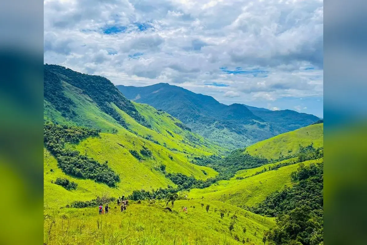
The grassy sections can make Ta Giang look easy in photographs, but the full walk still requires stamina. Repeated stream crossings, slippery stones and a long day with a pack create problems that may not show up in an elevation chart. A stream that was shallow in the morning can rise after rain upstream. Conditions in Khanh Hoa must be checked locally; the weather forecast for Dalat city is not enough.
For a first Ta Giang trip, choose an organized group with a local leader who knows the waterways, campsites and exit route. Ask who decides whether a crossing is safe and how transport will meet the group at the far end. A porter may carry luggage, but the role of route leader needs to be clear. Do not mistake “an easy gradient” for permission to undertake an overnight stream trek alone.
79 Trekking charged VND 2,990,000 per person for its two-day, one-night, 20 km Ta Giang trek departing 11 April 2026. Prices vary by operator and departure. On a new booking, reconfirm departure city, transport, meals, camping equipment, luggage handling and weather cancellation terms.
If Dalat is your holiday base, Ta Giang needs a separate travel plan into Khanh Hoa. Two days on a Ta Giang trekking itinerary should not be read as two days including a relaxed round trip from your hotel in Dalat. Travelers who want an organized two-day forest experience closer to the city will usually find Bidoup more geographically convenient.
The best half-day Dalat hiking plans
A good half-day plan is one that leaves enough time to descend safely, clean up and enjoy the rest of your holiday. It is tempting to turn a morning hill walk into a complicated schedule of viewpoints and cafés, but the trail's duration is not the same as the door-to-door duration. Road travel, finding the entrance, parking and rest stops are all part of the day.
Short hill walk: Travel to the Hon Bo approach in daylight, park legally, walk to a reasonable viewpoint and return by the same established path. Allow one to three hours at the hill depending on where you begin. Stop at a viewpoint below the top if the ground or your group's pace makes that the better decision. This plan suits someone arriving in Dalat for only a weekend.
Guided forest introduction: Book the Thien Thai route. The walk itself is half a day, but add the return journey to the park's visitor center about 36 km from Dalat. Get a confirmed meeting point and departure time from the park rather than simply turning up and expecting an immediate group start.
Flexible urban walk: Use Xuan Huong Lake. The full circuit is approximately five kilometers and can take around one to two hours depending on stops. It is a paved city walk. It remains a sensible way to stretch your legs after a long bus ride, especially if fog, rain or restricted forest access have changed your hiking plans.
How to spend one full day on the trails
With a full day available, make one substantial walk the centerpiece. Pinhatt works for people seeking climbing effort and a view over Tuyen Lam Lake. The Thien Thai to Dung Jar Gieng route works for visitors wanting a 10 km guided experience with a clear park program. Both involve enough walking that trying to complete them on the same day is unnecessary.
Pinhatt needs a permitted trailhead chosen in advance. Leave the hotel early, allow time to park, take the climb at a steady pace and keep a generous margin for the descent. An early afternoon finish is more comfortable than returning to a remote starting point near dusk. A meal near Tuyen Lam Lake is a good post-hike option without adding another trail.
A national park day runs to a tighter structure. Meet the guide at the designated location, follow the briefing, walk at the group's pace and return using the agreed plan. If the park has to change the route because of weather or operational conditions, the trip still needs to fit the day's available daylight. A 10 km walk does not improve because someone tries to hurry the last three kilometers.
Langbiang can also fill a day when the summit route is officially receiving trekkers. Confirm that access first, before you start looking at maps. When summit entry is unavailable, treat the jeep-accessible tourist area as its own sightseeing trip.
How to plan a two-day trek without rushing the logistics
The choice between Bidoup and Ta Giang is not simply which route has the better photographs. Bidoup is a highland forest summit itinerary within a managed national park. Ta Giang is a longer journey through forest, streams and grassland in Khanh Hoa. Their overnight experiences and travel logistics are different.
At Bidoup, ask the park how the two walking days are split, where the camp is set up, what sleeping equipment is supplied and whether your start and finish points require different vehicles. You will be walking at higher elevation, so a warm, dry layer is important even when Dalat town feels mild. Confirm food and water arrangements rather than packing based on assumptions.
Ta Giang starts with one decision: settle your meeting city before buying any other tickets. Cam Ranh or another Khanh Hoa meeting point may be much more useful than Dalat. Ask about stream conditions, the precise camp location and where the group will emerge on day two. Tell the operator about any member who has never walked twenty kilometers across two days.
Neither journey should be scheduled immediately before an inflexible long-distance departure. A late descent, unexpected trail closure or road delay can affect onward transport. Give yourself a margin, particularly in the wet season. The best two-day trek is the one you can finish with reasonable reserves of energy and time.
When can you hike independently, and when should you book a guide?
Walking independently is appropriate on clear public routes that you are allowed to use. The circuit of Xuan Huong Lake is the simplest example. Public paths near Tuyen Lam Lake can also work for a gentle walk, as long as you stay out of restricted forest, private resorts and areas where access is controlled. It is not necessary to push into an unmarked forest track to say you have been hiking in Dalat.
At Hon Bo and Pinhatt, independent walking demands more judgment. Check whether the approach is currently accessible, carry offline maps and tell someone where you will start and when you expect to return. Having good physical fitness does not guarantee navigation skill. If you are unsure which turn to take, a guide is usually a better investment than trying to interpret conflicting online GPS tracks on site.
Within Bidoup Nui Ba National Park, register for the authorized activity and follow the park's guides and ranger instructions. Do not equate the ability to reach a location with permission to enter it. In protected forest, management requirements apply even to experienced trekkers. Arrange camping only through the appropriate approved program.
Langbiang requires particular care because the forest summit trail has opened and closed in the past. The status of the tourist area's jeep road does not prove that the forest trail is available. Confirm authorized access and the guiding requirements directly before traveling. A tour listing should be checked against the route it actually operates.
At Ta Giang, strong local knowledge is especially valuable around streams and overnight camps. Select a route leader, not merely somebody who can carry the bags. Your group should know who makes the stop-or-go decision, how the team stays together and where they will head if the main crossing becomes impassable.
Hiking seasons: when dry trails matter more than green scenery
Dalat generally has a drier season from November through April and a wetter season from around May to October. April and November can be transitional, so the month alone does not tell you whether a particular slope is safe. Rainfall in the preceding days may matter more than clear skies when you leave your hotel.
December through March is often a practical window for travelers who want more predictable footing. Mornings at elevation can be cold, and overnight camps can be colder than the streets of Dalat. Take warm clothing without underestimating dehydration. Comfortable temperatures do not mean you can hike for hours without sufficient drinking water.
During the wet season, forest vegetation becomes lush but red-earth trails can be muddy, roots slick and rock crossings difficult. Pinhatt's downhill sections need special attention after rain. Hon Bo may be misty with poor visibility early in the morning. Bidoup routes depend on the park's operational assessment, while Ta Giang stream conditions can change independently of Dalat's weather.
Do not make a rigid promise to trek because a tour has already been paid for. Ask the operator what happens after heavy rain and whether a different route or rescheduled departure is offered. Change plans when the route manager, the guide or the weather says the walk should not go ahead.
What to pack for Dalat hiking trails
Footwear comes first. Choose shoes you have already worn on uneven ground, with a sole that grips damp soil and stone. Brand-new hiking boots can cause blisters if you first try them on a long descent. Bring socks that stay comfortable when walking and a spare dry pair for an overnight trip or a route with wet crossings.
For a half-day walk, carry drinking water, an easy snack, sun protection, a compact rain layer and a light jacket. Fully charge your phone, download your map for offline use and keep the number of your guide or driver accessible. A small first-aid kit and any regular medication should be easy to reach rather than buried under spare clothes.
A full-day forest walk needs additional margin: extra food, a headlamp, a power bank, some basic blister care and a waterproof bag for electronics. Long pants and sleeves help protect against scratches and insects. Bright or easily recognized clothing can also help members of the group see one another in dim forest light.
The appropriate water quantity varies with temperature, duration, effort and whether the guide has confirmed a supply point. Never assume untreated stream water is safe to drink. A tour that includes lunch may not provide unlimited drinking water, so check what is supplied. Relying on the guide for water? Ask where the refills are and what happens if that source is unusable.
Overnight trips need a separate equipment check with the operator. Who supplies the tent, sleeping bag and sleeping mat? Are meals cooked by the team, and where is the water obtained? Is a porter included? How much personal weight must you carry? The Bidoup park tariff lists a sleeping bag and tent in its summit package, but individual sleeping arrangements still need confirmation before departure.
Keep your night clothes dry in a sealed inner bag and avoid carrying unnecessary bulky clothing. A comfortable walking outfit, one warm layer, weather protection and a limited set of clean items are generally more useful than bringing extra outfits for photographs. Trekking poles may help on steep descents, but they do not remove the need to move carefully.
Rain and stream safety: decide when to turn back before you start
Check the forecast for the specific mountain area, not just Dalat's central district. Contact the relevant guide or route manager close to departure to ask about closures, ground conditions and high water. Agree on a turnaround time based on the slowest walker and available daylight. That decision is easier to follow when the entire group accepts it beforehand.
Thunderstorms add a different risk. Leave exposed ridge tops and avoid standing beneath isolated trees. Never climb over a closed-route barrier or cut a new path into protected forest because the official line looks inconvenient. Respect local communities and farmland, keep noise low, and take all trash back out.
How to compare a Dalat trekking tour before paying
The total price is only part of the decision. A “Bidoup trekking” tour might cover a short park interpretation route, a long day or the overnight summit. A “Langbiang trip” may include a jeep-accessible viewpoint rather than the forest summit. A “Ta Giang tour” may meet in Khanh Hoa, with no transport from Dalat included.
Before paying, request six practical details in writing: the exact trail and meeting location; total distance and significant climbing; expected walking and finish times; guide arrangements and permission to operate the route; what the price includes; and the procedure for rain, closure or cancellation. International travelers should also ask about the guide's working language and who can coordinate emergency assistance.
Make sure you are comparing similar products. Bidoup's basic VND 40,000 park entrance listing is not the price of the summit expedition. The listed VND 1,950,000 summit package contains meals and camping equipment. Another park overnight product, Dung Jar Gieng at VND 950,000, lists only a guide and insurance in its inclusions. The price gap comes from what each package includes.
That 2026 Ta Giang price was for one departure, and the next one can cost more or less. Ask for the current price in Vietnamese dong, the payment and refund rules, transport from the meeting town, accommodation arrangements and group size. An apparently cheaper operator may be excluding an essential transfer or the camping equipment that another operator includes.
Non-Vietnamese speakers should confirm whether the guide can explain changes to the itinerary in English. The ability to give a short trail briefing is different from being able to coordinate transport and emergency decisions during difficult weather. Make the expectations clear at booking rather than discovering the gap in the forest.
Three sensible Dalat hiking itineraries
First-timer, one or two days in Dalat: Start with a walk around part of Xuan Huong Lake to get moving after travel. Use a separate morning for Hon Bo if the weather is good and the approach has been confirmed. To get a real taste of the forest, swap Hon Bo for the guided Thien Thai trail and allow extra driving time. There is no need to spend a first hiking holiday sleeping in a tent.
Active walker, one free day: Choose Pinhatt when you enjoy climbing, want views over Tuyen Lam Lake and have somebody who knows the legal route. Choose the 10 km Thien Thai to Dung Jar Gieng program when you prefer an organized walk through national park forest. They are not interchangeable: one is about a hillside viewpoint, the other about a longer guided nature route.
Experienced hiker, two days: Contact Bidoup Nui Ba National Park about the authorized summit program and the exact daily distances. If you are more interested in open grassland and streams, organize Ta Giang as a separate Khanh Hoa trip with local leadership and proper transport. Keep the plan flexible enough to postpone a crossing or a highland hike after heavy rain.
FAQ
Can I do Bidoup Nui Ba National Park trekking without a guide?
You can arrange your own transport to the visitor center, but do not enter protected forest or attempt the Bidoup summit independently without the park's authorization. Book a permitted program and follow its guide and ranger requirements. A downloaded GPX track does not provide legal access to a restricted trail.
How long is the Ta Giang trek, and is it near Dalat?
Ta Giang is in Tay Khanh Son Commune, Khanh Hoa Province, a separate trip from Dalat. It is about 12 km to the grasslands, and a full overnight trek covers 20-22 km. Ask the operator where the walk starts and finishes, since the distance depends on the route.
What is the best Dalat hike for beginners with just half a day?
Hon Bo is a short hill outing close to town when the weather and access are suitable. The guided 3.5 km Thien Thai route is a better choice for a first forest walk within the national park. If you only want easy walking, the approximately 5 km Xuan Huong Lake circuit is accessible, but it is an urban walk rather than a wilderness hike.
Is the Langbiang summit trail open for independent hiking?
Don't count on it. The forest trail to the 2,167 m Nui Ba summit has closed and reopened more than once; confirm the entry rules with the route manager before you go. A jeep ride to Radar Hill is a separate tourist activity and does not prove that the summit trekking trail is open.
When is the best season for Dalat hiking trails?
The generally drier period from November to April offers a better chance of manageable trail conditions, with December to March often practical for longer walks. Recent rain, park closure notices and stream levels still take priority over the calendar. Avoid attempting exposed slopes or stream crossings when the guide says conditions are unsafe. For official forest routes, contact Bidoup Nui Ba National Park at +84 263 350 2005 and ask about the program, meeting point and current access rules. Its representative office is at 22 Pasteur Street, Xuan Huong-Dalat Ward, Lam Dong Province.